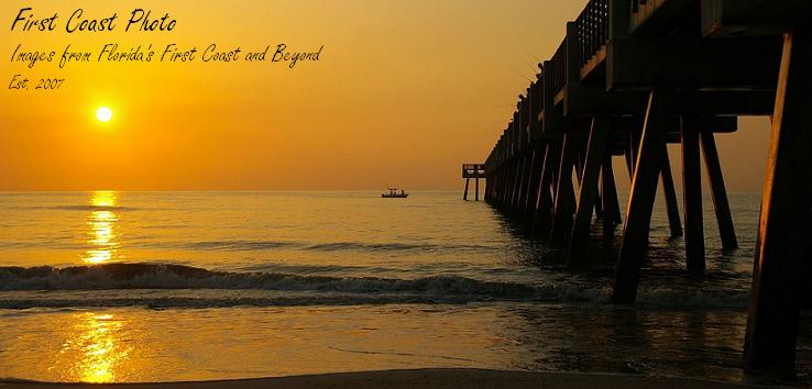
.JPG)
A colorful set of boxcars waiting near a factory in Fernandina, FL.
Been away a few days battling allergy and sinus issues - the joys of spring - but I should be back blogging again now... until the next set of flowers bloom. :)


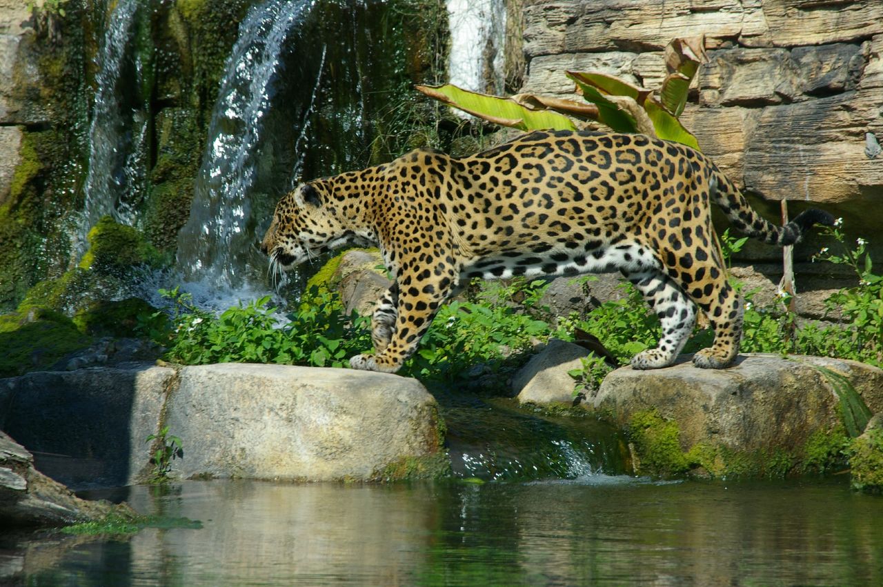
One of the beautiful Jaguars at the Jacksonville Zoo.
But of course these days the most well known Jaguars from Jacksonville are the professional football team:
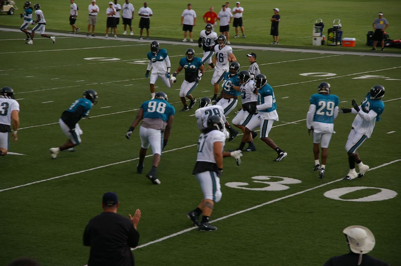 Jacksonville Jaguars NFL team practice from August 2007.
Don't forget to visit Mrs Nesbitt's Place for other ABC Wednesday participants!
.JPG) It was quite windy - the birds are all facing the same direction so the stiff breeze doesn't ruffle their feathers - literally. :)
It was quite windy - the birds are all facing the same direction so the stiff breeze doesn't ruffle their feathers - literally. :) View sitting in a car while on the ferry:
 .JPG) Bridge of the ferry and cars parked in rows upon it.
Bridge of the ferry and cars parked in rows upon it.
.JPG) A few Mayport shrimp boats - lots of shrimpers and fisherman come out of Mayport.
A few Mayport shrimp boats - lots of shrimpers and fisherman come out of Mayport.
.JPG) The ferry about to dock at the south station in Mayport proper.
The ferry about to dock at the south station in Mayport proper.
.JPG) This fun gentleman was one of the ferry attendants, directing cars off of the vessel after we docked. He was a hoot - he would dance and sing and wave the next car off, then dance and sing his way to the next row and repeat. He even posed for my wife when it was our turn but the combination of sun and shadow confused the camera and it wouldn't focus in time to get a picture - drats. You can see my wife in the side mirror of the car taking this photo - a photo of a photo being taken - always fun. :)
This fun gentleman was one of the ferry attendants, directing cars off of the vessel after we docked. He was a hoot - he would dance and sing and wave the next car off, then dance and sing his way to the next row and repeat. He even posed for my wife when it was our turn but the combination of sun and shadow confused the camera and it wouldn't focus in time to get a picture - drats. You can see my wife in the side mirror of the car taking this photo - a photo of a photo being taken - always fun. :)
.JPG)
.JPG)
.JPG)
One of the soldiers cleaning and inspecting his rifle.
.JPG)
You've got to watch out for this guy - he has a Canon.
Haha. A little photography humor for you. :)
.JPG)

.JPG) A view from the back of the Mayport Ferry, an auto ferry that crosses the St. Johns River from Mayport, Fl on the south bank to well... a ferry station on the north bank that is not near any true town - all of which is technically part of Jacksonville, Fl.
A view from the back of the Mayport Ferry, an auto ferry that crosses the St. Johns River from Mayport, Fl on the south bank to well... a ferry station on the north bank that is not near any true town - all of which is technically part of Jacksonville, Fl. .JPG) The south wall of the fort, facing inland, with the fort road winding through
The south wall of the fort, facing inland, with the fort road winding through .JPG) A Confederate sentry standing guard at the main entry, or sallie port.
A Confederate sentry standing guard at the main entry, or sallie port.
With no true garrison present at the start of the Civil War, the Confederates simply took control with no resistance. The Rebels didn't attempt to finish the fort, but they did establish some gun batteries in the fort and other places on this island and across the inlet on Cumberland island, Georgia. With resources stretched thin, however, the Confederates decided in 1862 that they couldn't cover every single island outpost and abandoned most of them, allowing the Union to retake the fort - again without a shot fired - in March 1862. The Union, led by the 1st New York Engineers, then continued to work on the fort and by 1867 it was nearly completed (the war ended in 1865) when the army decided to deactivate the fort and construction was halted.
.JPG) A view of the fort's interior showing one of the completed barracks. The flag flying is an early Confederate flag from Florida that reads: "Hurrah for Florida! Let us alone!"
A view of the fort's interior showing one of the completed barracks. The flag flying is an early Confederate flag from Florida that reads: "Hurrah for Florida! Let us alone!"
The fort was reactivated for the Spanish American war in 1898 but while a mount was built to hold a modern gun, it was never put in place and the fort was again abandoned in September of that year. The army sold the fort and land to private buyers in 1926 and in 1935 the state of Florida bought the complex for preservation and outdoor recration. The Civilian Conservation Corps (a byproduct of the "New Deal" from President Franklin D. Roosevelt to pull America out of the Great Depression) developed the property into Fort Clinch State Park, with the fort, nature trails, camping, beach access, and wildlife protection.
.JPG) Confederate artillerists fire a Civil War era 3 inch Ordinance Rifle. (3 inch refers to the size of the shell fired.) This would not be used in a fort, but none of the larger guns in the fort are opperational, so they use this smaller gun for demonstration purposes.
Confederate artillerists fire a Civil War era 3 inch Ordinance Rifle. (3 inch refers to the size of the shell fired.) This would not be used in a fort, but none of the larger guns in the fort are opperational, so they use this smaller gun for demonstration purposes.
.JPG) Another view of the fort's internior, showing a building that is used for storage and staff offices. The large cannon on the right of the building are 10-inch Rodman Seacoast guns, a common Civil War-era fort cannon. More about the Rodmans and closeup photos Saturday.
Another view of the fort's internior, showing a building that is used for storage and staff offices. The large cannon on the right of the building are 10-inch Rodman Seacoast guns, a common Civil War-era fort cannon. More about the Rodmans and closeup photos Saturday.
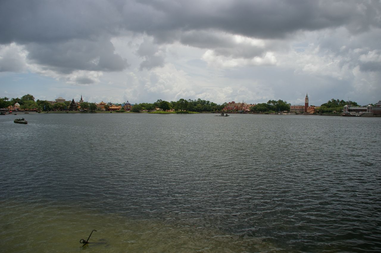 A view over the "World Showcase Lagoon"
 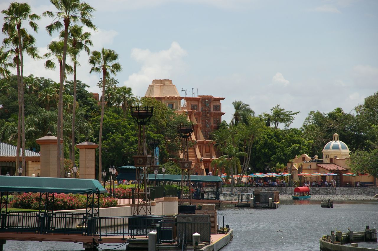 Mexico
 Germany
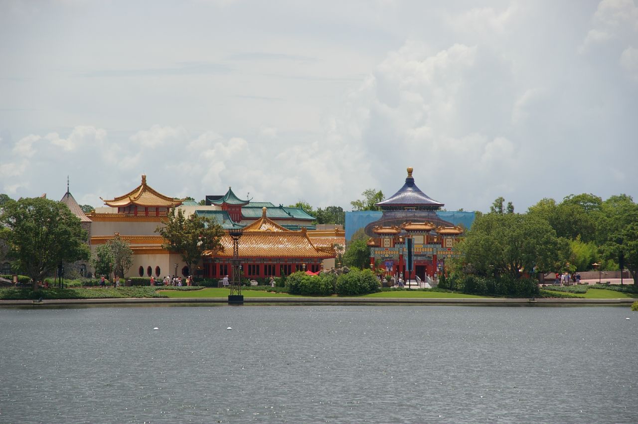 China
China Shrimp boats docked in Fernandina .
.JPG)
Part of the rich history of the area includes that of pirates. (Now the mascot of the local high school.) Pirates as "great" as Captain Morgan, Calico Jack, Black Bart, and Luis Aury all put in to port there over the years.
.JPG)
"Peg Leg Pete" the pirate statue downtown.
Also important in the towns history is the railroad. Before and during the Civil War, there were only two major railroads in Florida - one ran from Jacksonville west past Tallahassee, and the other ran from Cedar Key on the Gulf of Mexico to Fernandina on the Atlantic. This made Fernandina a very strategic location for trade and an important military target, leading to the construction of various fortifications over the years, culminating in the US built Fort Clinch, which we will explore tomorrow.
.JPG)
A gentleman decked out in historic train conductor garb.
Finally, I must mention a lovely little cafe we ate at called the Happy Tomato Cafe. Wonderful pulled pork and pulled turkey Bar-B-Que (there is more on the menu, but we opted for BBQ). Great stuff, the way it is supposed to be made. If you are ever in town and want some good Florida BBQ, this is a good place to go downtown.
.JPG) BBQ Turkey and all the fixins'. Yummy!
BBQ Turkey and all the fixins'. Yummy!.JPG) The Ribalut Club (technically pronounced Re-bow, not Ree-balt as we locals call it) was originally opened in 1928 as a resort catering to wealthy locals and vacationing Northerners. At that time Jacksonville was the popular vacation spot in Florida as Miami and other points further South were nothing but malaria infested swamps.
The Ribalut Club (technically pronounced Re-bow, not Ree-balt as we locals call it) was originally opened in 1928 as a resort catering to wealthy locals and vacationing Northerners. At that time Jacksonville was the popular vacation spot in Florida as Miami and other points further South were nothing but malaria infested swamps..JPG) The Ribault Club flourished for a while, adding an additional lodge in 1930 to accomodate the 350 members. Some ammenities included: a library, grand fireplace, numerous rooms, outdoor activities such as lawn bowling, and a 9-hole Scottish style golf course, not to mention easy access to sailing and boating.
The Ribault Club flourished for a while, adding an additional lodge in 1930 to accomodate the 350 members. Some ammenities included: a library, grand fireplace, numerous rooms, outdoor activities such as lawn bowling, and a 9-hole Scottish style golf course, not to mention easy access to sailing and boating.
.jpg) The Great Depression put an end to most of the fun, however, and the club was sold numerous times until finally falling into disrepair by the late 1900's. In 1989 the State of Florida purchased the property and is in the process of revitalising the facility. It currently hosts many weddings and receptions, a museum, and will eventually be the main visitor's center for Ft. George island.
The Great Depression put an end to most of the fun, however, and the club was sold numerous times until finally falling into disrepair by the late 1900's. In 1989 the State of Florida purchased the property and is in the process of revitalising the facility. It currently hosts many weddings and receptions, a museum, and will eventually be the main visitor's center for Ft. George island.
One other structure we stopped by briefly to snap a few photos of from the car is the St. George Episcopal Church, originally built in 1882-1883 and still an active parish. I would have liked to have gotten out to get some better photos and perhaps go inside, but some members were getting the facility ready for palm sunday and I did not want to disturb their work.
.jpg)
Next up: Fernandina, FL
.JPG) View on the main road of Ft. George island, FL.
View on the main road of Ft. George island, FL. .JPG)
A view looking south from a bluff on the island's eastern side.
Tomorrow I will show some photos of our ultimate destination on the island - the Ribault club - for a state park sponsored lecture on the Timucuan indians and their place in history vs. the findings of archaeology.
.JPG)
A view from near the Ribault club looking north towards Big Talbot island. Note the tall sand dunes on the opposite shore.
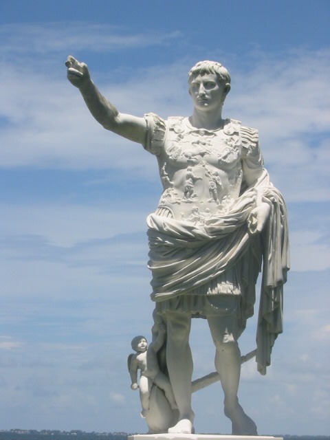 Yes today is March 15th - the Ides of March. If you have weird dreams or a wise old sage advises you to avoid something, maybe you should listen and not miss the point. Actually, old Julius would have missed the point if he had listened, haha...
 These rhinos at the zoo were kind enough to slowly move into a single line facing away from us so we could get the postcard picture perfect photo of something you don't see everyday... three huge hineys in a row staring you in the face... if only they were hippos I could have had the trifecta! :)


.JPG)